
Survey Corrections Beta
MWD Survey Corrections and Multi-Station Analysis
Analyze six-axis MWD measurements, verify magnetic and grid references, and calculate corrected inclination, azimuth, and wellbore position.
Compare raw and corrected surveys, inspect per-run results, and review calculated positional uncertainty.
Beta — independent verification required. Results must be independently reviewed before operational or final well-positioning decisions.
Survey Analysis
From Measurements to Corrected Surveys
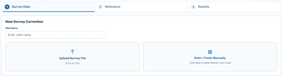
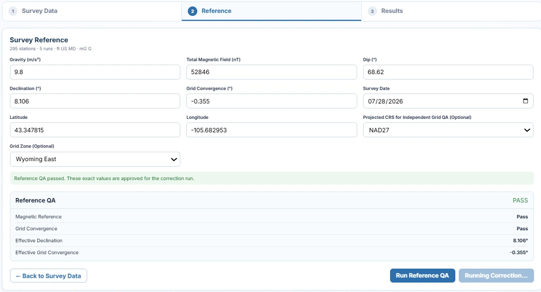
Import survey measurements, check magnetic and coordinate references, then examine the corrected surveys and calculated wellbore position.
Survey Results
Raw and Corrected Surveys
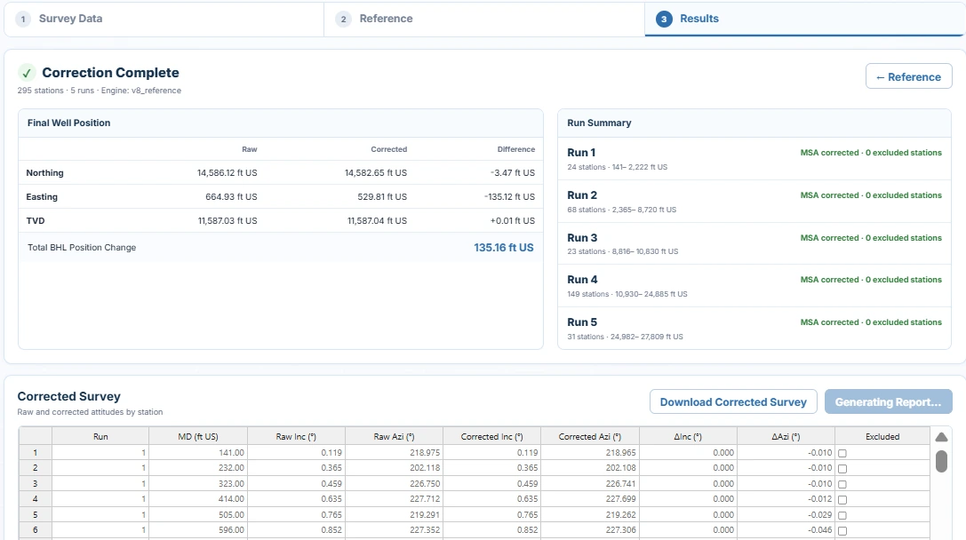
Compare wellbore trajectories and station-by-station changes in inclination and azimuth.
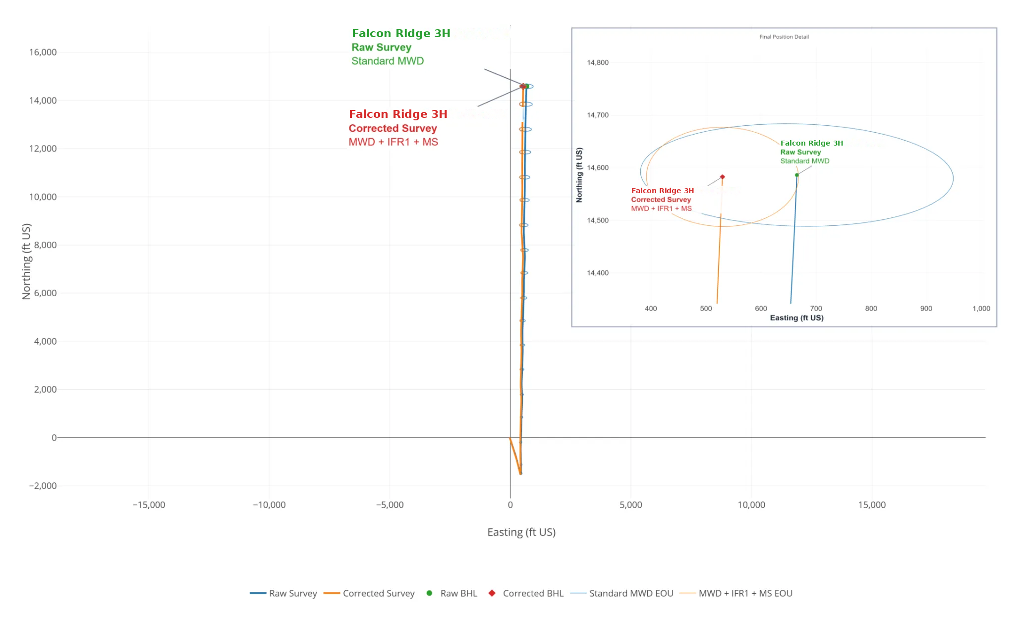
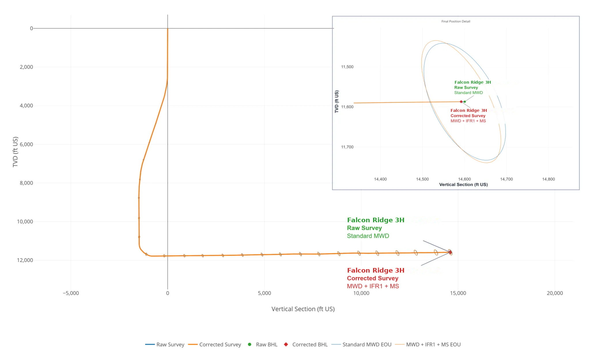
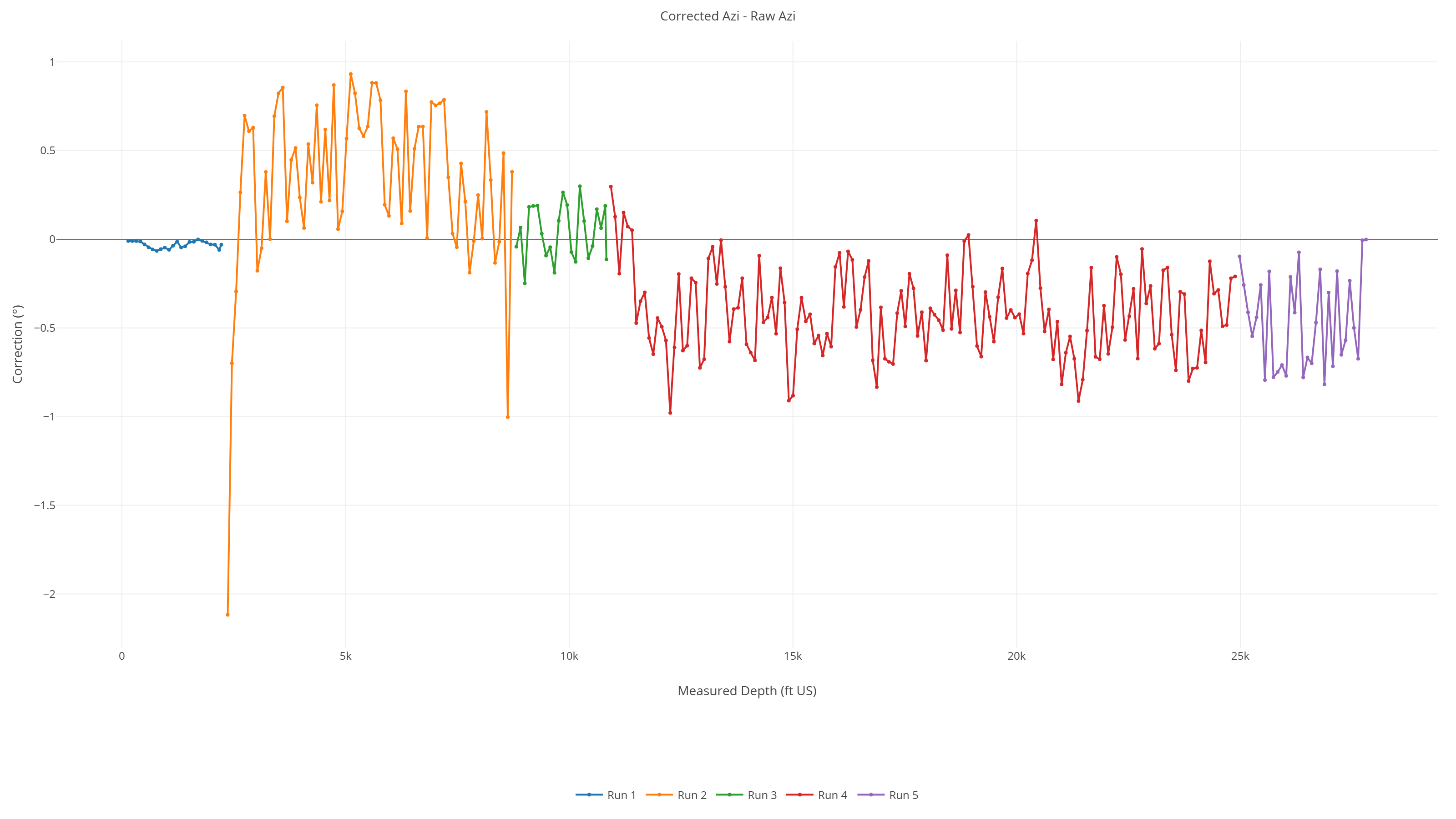
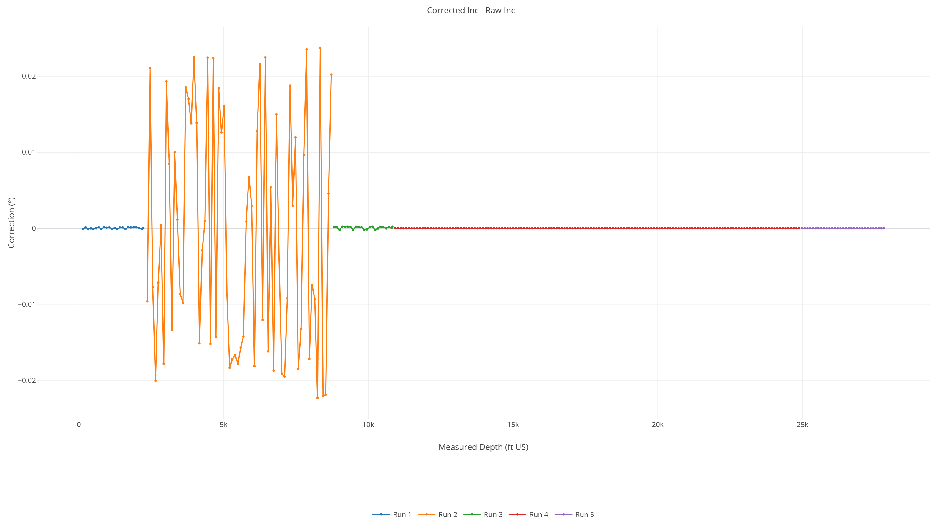
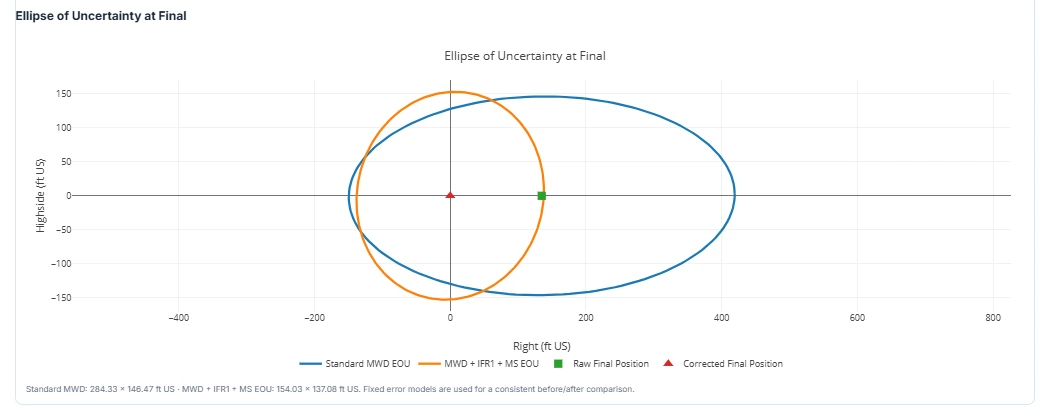
Example results from Falcon Ridge 3H. Trajectory ellipses use different assigned raw and corrected survey error models at 2 sigma.
Sensor Diagnostics
Magnetic and Gravity Measurements
Review measured and corrected sensor values alongside the references used in the analysis.
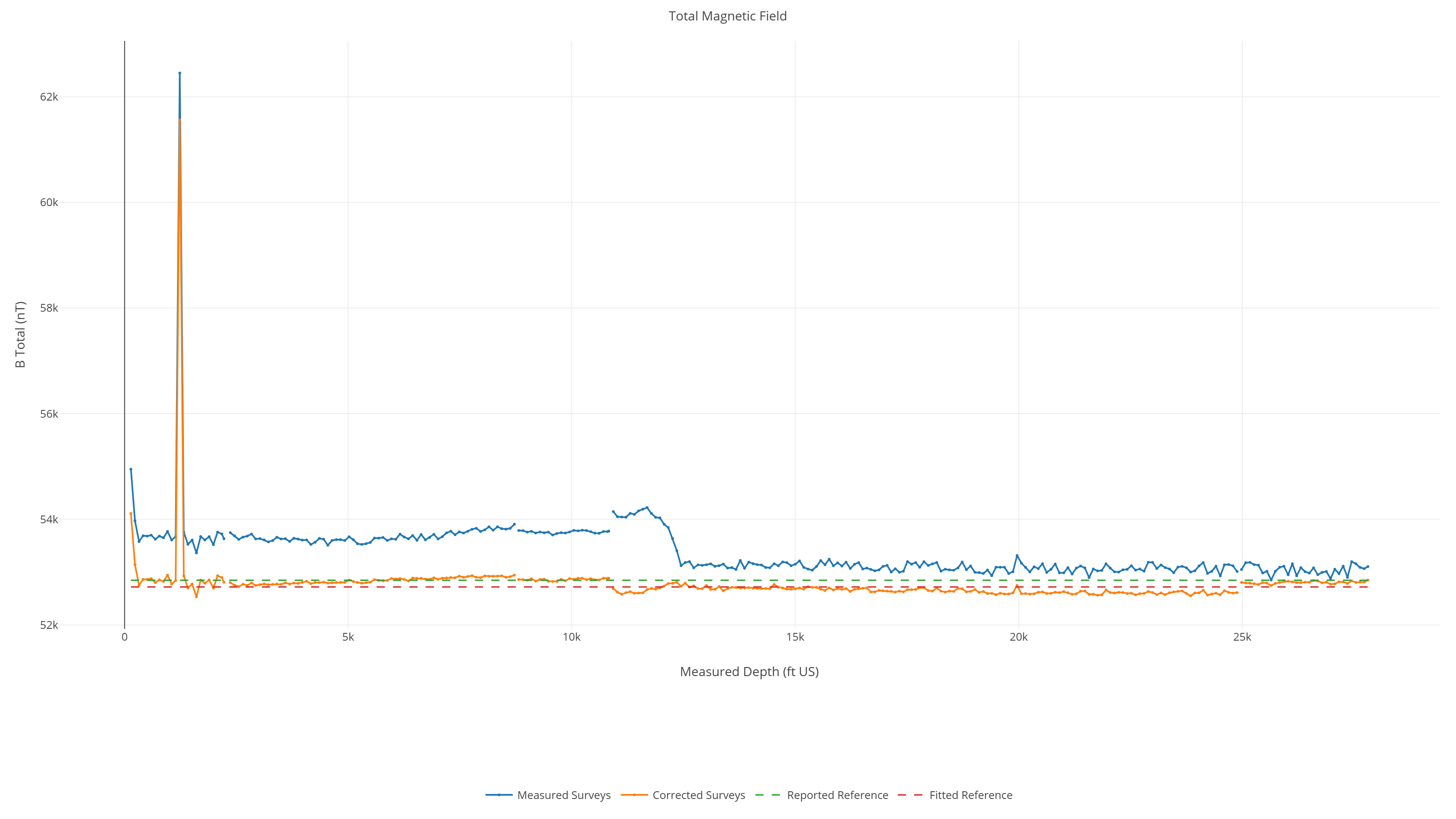
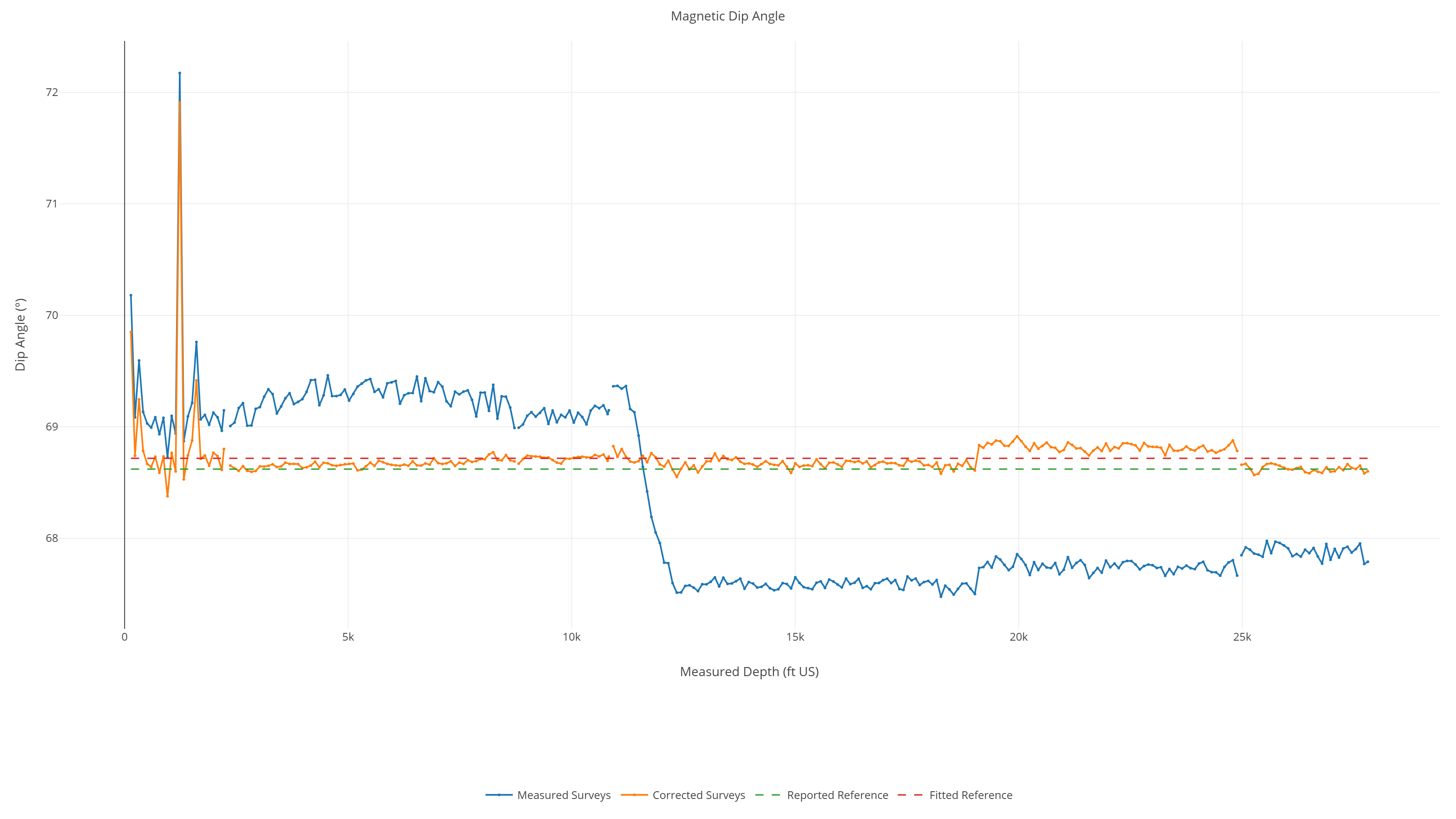
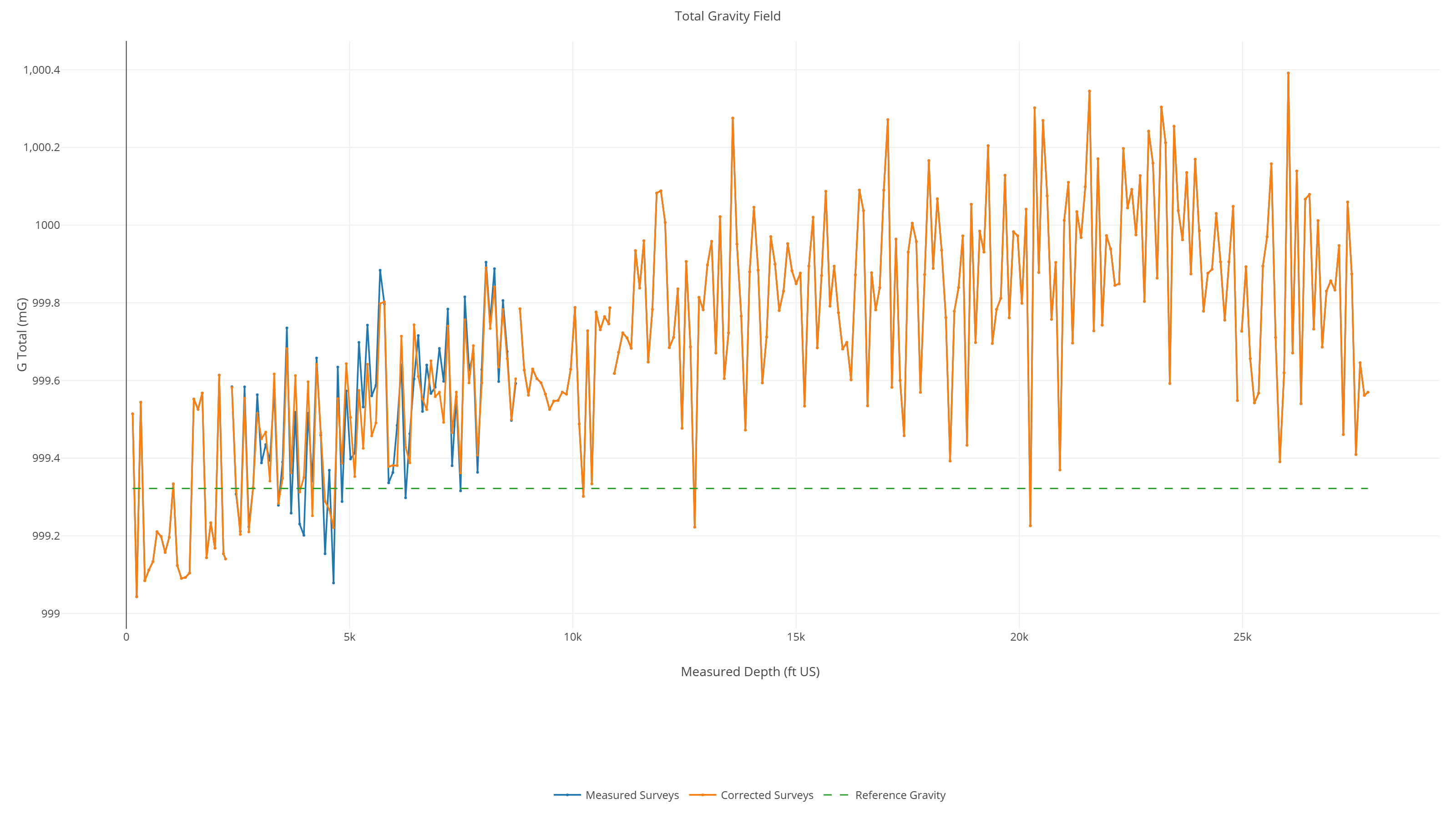
These plots assess sensor/reference consistency, not independent bottom-hole positional accuracy.
Survey Corrections
Explore the Correction Tool
Upload raw survey measurements or enter data manually to review reference checks, corrected survey stations, and calculated position changes.